Monday 6 July 2015

Thenmala


Thenmala is the meeting point of kollam-Shencottah road and Trivandrum-Shencottah road, surrounded by dense forest, 66 kms east of kollam. There are a large number of rubber and tea plantations in Thenmala. Timber of all varieties are exported from here to all parts of the country. Themala Dam site is open for tourists. Eco tourists centre is situated at Thenmala.

Thenmala is a tourist place near Punalur town, Kollam district in Kerala. Thenmala is the first planned eco-tourism destination in India. The Thenmala dam was built across Kallada River. Thenmala is famous for being the shooting location in Malayalam and Tamil movies.

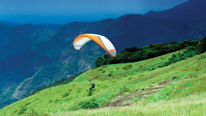
Thenmala attracts foreign and domestic tourists with a host of attractions. Boating on the lake, a rope bridge, trekking, mountaineering, biking and a musical fountain. Thenmala is approachable both from Trivandrum and Punalur by road. The waterfall called Palaruvi is a prime attraction nearby. Also nearby is a deer rehabilitation center where visitors can see deer in a forest setting and have a peep into a traditional tree house used by forest dwellers to escape harm from wild animals. Other places near Thenmala are Kulathupuzha, Anchal, Punalur, Kamukumchery and Sengottai in Tirunelveli district (Tamil Nadu). Themala is 72 km from Thiruvanathapuram and 16 km from Palaruvi Falls.

Nedumpara

Nedumpara is a scenic place located 7 Km from Thenmala. Harrisons Malayalam Limited has a rubber estate in this place named as Isfield Estate. One of the highest peak of the village is located in Nedumpara, which is locally known as Nedumpara Motta. Village first school TC Nariyarath Memorial Higher Secondary School (TCNMHSS) located in the valley of 27th Hills. Nedumpara is home for Multiple sports clubs Like Players Cricket Team and NSAC Football Academy.Incredible Nedumpara is the official Facebook page which holds local updates from the place in social media. Ambanad hills is just 8kms from Nedumpara.
 
Main Tourist Attractions
  • Thenmala Eco Tourism Centre:
Thenmala Eco Tourism is India’s first planned eco-tourism destination, which is gaining popularity due to its unique vistas, bio-diversity and functioning. Situated about 72 kms from Thiruvananthapuram, in the District of Kollam, the Thenmala Eco-Tourism shares its resources with the famous Shenduruney Wildlife Sanctuary at the foothills of the Western Ghats.
  • Thenmala Reservoir
Image result for Thenmala
 
  • Deer Rehabilitation Centre: 
This deer park of Thenmala is a distant part of Thenmala eco tourism and is built within the Kallada river side forest. Apart from various varieties of deers what you can see interesting here is a Tree House and a small Childrens park with  some ecologically blended resting places.

Wayanad

Wayanad is the 12th District in Kerala was formed on 1 November 1980  by carving out areas from Kozhikode and Kannur districts. Kalpetta is the district headquarters as well as the only municipal town in the district. The region was known as Mayakshetra (Maya's land) in the earliest records. Mayakshetra evolved into Mayanad and finally to Wayanad. The Folk etymology of the word says it is a combination of Vayal (paddy field) and Naad (land), making it 'The Land of Paddy Fields'. There are many indigenous tribals in this area. It is set high on the Western Ghats with altitudes ranging from 700 to 2100 m.

Image result for wayanad

Attractions in Wayanad
•    Kalpetta: It is the district headquarters of  Wayanad, is the only municipality in this hilly region. The town has hotels, bars, restaurants and shops, making it a convenient base to visit this place while at the same time enjoying these facilities.
•    Pookot Lake
•    Edakkal Caves
•    Pakshipathalam
•    Lakkidi: The gateway to Wayanad, Lakkidi is situated 700 m above sea level, at the crest of the Thamarasseri Ghat Pass. Lofty peaks, gurgling streams and luxuriant forests add magic to the journey up the winding roads to this hill station. (5 km south of Vythiri)
•    Sulthan Bathery: This Place is situated at about 930 meters above mean sea level. One can find beautiful folded hills across the horizon. This town was part of Kidanganadu Village, which got its name because the presence of the Kidangans the tribes. Later, it came to be known as Sultan Bathery, the Malayalam version of its name.
•    Banasura Sagar Dam: This project is the largest earthern dam in India and the second largest in Asia. It is located in the midst of lovely, mist-clad hills with a wildlife sanctuary and park full of flowering trees.
•    Wayanad Wildlife Sanctuary: Wayanad Wildlife Sanctuary is an animal sanctuary It is spread over 344 km² & It is Situated on the way from Mysore to Sultan Battery in Wayanad, Kerala.Wild animals such as Indian Bison, Elephant, Deer and Tiger can be spotted here.Peacocks and Peafowl tend to be very common in the area. This is the second largest wildlife sanctuary in Kerala.
•    Neelimala view point : Closer to Vaduvanchal, Neelimala is an excellent venue for trekking with lots of stimulating trails. The summit of this hill affords a great view of the cascading Meenmutty fallsand the beautiful valley in its foreground.
•    Meenmutty falls: An interesting 2 km jungle trek off the main Ooty road, Meenmutty is the largest and most spectacular waterfall in Wayanad. A unique feature is that water drops about 300 metres over three stages.
Image result for wayanad

Kovalam


Kovalam is a beach town on the Arabian Sea located around 16 km from Thiruvananthapuram city, Kerala. It is also known as the paradise of the south. Kovalam means a grove of coconut trees and true to its name the village offers an endless sight of coconut trees. Kovalam has three beaches separated by rocky outcroppings in its 17 km coastline, the three together form the famous crescent of the Kovalam beach.
Kovalam means a grove of coconut trees and true to its name the village offers an endless sight of coconut trees.

History

Kovalam first received attention when the Regent Maharani Sethu Lakshmi Bayi of Travancore constructed her beach resort, Halcyon Castle, here towards the end of the 1920s. Thereafter the place was brought to the public eye by her nephew the Maharaja of Travancore. The European guests of the then Travancore kingdom discovered the potentiality of Kovalam beach as a tourist destination in the 1930s. However, Kovalam shot into limelight in the early seventies with arrivals of the masses of hippies on their way to Ceylon in the Hippie Trail. This exodus started the transformation of a casual fishing village of Kerala into one of the most important tourist destinations in all India.

Geography

Beaches

Kovalam has three beaches separated by rocky outcroppings in its 17 km coastline, the three together form the famous crescent of the Kovalam beach

Lighthouse Beach

The southernmost beach, the Lighthouse Beach is the one most frequented by tourists, Lighthouse Beach got its name due to the old Vizhinjam Lighthouse located on a 35 meter high on top of the Kurumkal hillock. The lighthouse is built using stones is colored in red and white bands and enjoys a height of 118 feet. It's intermittent beams at night render the beach with an unearthly charm.

Hawah Beach

Eve’s Beach, more commonly known as Hawa Beach, ranks second, in the early day, is a beehive of activities with fishermen setting out for sea. With a high rock promontory and a calm bay of blue waters, this beach paradise creates a unique aquarelle on moonlit nights.

Samudra Beach

A large promontory separates this part from the southern side. Samudra Beach doesn't have tourists thronging there or hectic business. The local fishermen ply their trade on this part.

Detour past Kovalam junction to land on Samudra Beach which is to the north of Ashoka Beach. One has the option to walk along the sea-wall too.The sight of the waves lashing on the rocks below is awesome. Shallow waters stretching for hundreds of metres are ideal for swimming. The beaches have steep palm covered headlands and are lined with shops that offer all kinds of goods and services.

The larger of the beaches is called Light House Beach for its 35 metre high light house which towers over it atop Kurumkal hillock. The second largest one is Hawah Beach named thus for the topless European women who used to throng there. It was the first topless beach in India.[citation needed] However topless bathing is banned now except in private coves owned by resorts. Visitors frequent these two beaches. The northern part of the beach is known as Samudra Beach in tourism parlance. A large promontory separates this part from the southern side. Samudra Beach doesn't have tourists thronging there or hectic business. The local fishermen ply their trade on this part. The sands on the beaches in Kovalam are partially black in colour due to the presence of ilmenite and Monazite. The normal tourist season is from September to May. Ashoka beach is also the part of Kovalam beach.

Tourist facilities


There are a large number of beach resorts in and around Kovalam. The sea port of Vizhinjam is about 3 km away and famous for its special varieties of fish, old Hindu temples, big churches and a mosque. The Proposed International Trans shipment Terminal at Vizhinjam is also close to Kovalam.

Kovalam was among the most prominent tourist spots in India during the hippy era. It still has a high status among tourists, who arrive mostly from Europe and Israel. Kovalam is finding a new significance in the light of several Ayurvedic salons, and recuperation and regeneration resorts which provide a wide variety of Ayurvedic treatments for tourists.

Politics


Kovalam assembly constituency is part of Trivandrum (Lok Sabha constituency). The assembly constituency of Kovalam is represented by Jameela Prakasham of Janatha Dal. She defeated the sitting MLA Adv. George Mercier.

Vagamon


Vagamon is a hill station situated 1,100 meters above sea level. located in Kottayam-Idukki border of Kerala. It has a cool climate with the temperature between 10 and 23 °C during a summer midday. Vagamon also known as the ‘Scotland of Asia’, was discovered by the Britishers who found the place ideal for tea plantations and they were followed by Christian missionaries who built their abode of service at Kurisumala in Vagamon.

Vagamon (Malayalam: വാഗമണ്‍) is a hill station located in Kottayam-Idukki border of Idukki district of Kerala, India. It has a cool climate with the temperature between 10 and 23 °C during a summer midday. It is situated 1,100 metres above sea level. Vagamon was discovered by the British who found the place ideal for tea plantations and they were followed by Christian missionaries who built their abode of service at Kurisumala in Vagamon. National Geographic Traveler has listed Vagamon on their directory of the '50 most attractive places to visit in India’.

Still untouched by commercialisation, the sleepy town with its scenic valleys, beautiful green meadows, enchanting pine forests, mists, fogs, tea estates, waterfalls with the overall greenery is really striking. The landscape is mostly hilly bald with green meadows. Vagamon is also home to a large variety of flowers and orchids. Cuddled up within three striking hills Thangal, Murugan and Kurisumala hills which are the representation of the chief religions in Kerala, i.e. Hindu, Muslim, and Christian which represent the cultural harmony. Vagamon has amenities for trekking, paragliding, mountaineering and rock climbing. However business interests are trying their best to exploit and sell and market vagamon for tourists. How much benefits the local people are receiving from tourism boom is to be seen. The efforts made by the Kurishumala Ashram have helped the farmers of vagamon to improve their earnings by ensuring better price for milk and marketing opportunities.

Vagamon is at the fringe of the Western Ghats and the foot hills on its lower side reach up to Teekoy with a gradual descent. This narrow strip of descending land gives a vital connectivity to the plains as both sides of vagamon up to kuttikkanam on the south west and moolamattom on the north east, are marked by steep and inaccessible hill slopes. Travelling by the hill highway in this section is an exhilarating experience with deep valleys and magnificent views all around. Vagamon presents very spectacular views with an ethereal touch. Vagamon's charm is worth experiencing and is indeed one of the must see places for tourists. Reaching Vagamon itself is an extraordinary experience. The meandering road to Vagamon is cut in solid rock lined with pine forests. And as you wind your way through green capped hills, the rolling plains come into view thousands of feet below you. The road to vagamon from Erattupetta opened an easily accessible and direct route to vagamon from the plains. This road which was constructed in the 1950s was an engineering marvel and is rated a state highway. The road was made in treacherous and dizzying terrain under the initiative and leadership of Acharya Francis who established the Kurisumala Ashramam. About a dozen workers died during the construction at the hanging cliffs and a 20 foot tall memorial tower stands in honour of those who gave their life for this road project at the beginning of the road in Teekoy town junction. One more speciality is there IBM software company is getting developed in VAGAMAN near Management College.

Vagamon is located 15 km from kottamala 39 km from Thodupuzha, 33 km away from Palai, 45 km from Kumily, 22 km from Kuttikanam and about 65 km from Kottayam. Cochin International Airport is the nearest airport while the closest railway station is Kottayam. There are many fine resorts available in the surrounding areas with affordable cost for trekkers. Key tourist centers such as Thekkady, Peermade and Kulamavu are straightforwardly reachable from Vagamon.